Experience

Archaeologist working on a dig

Bighorn has participated in the recording of hundreds of sites of nearly every description throughout the Intermountain Region, and Northwestern States.  

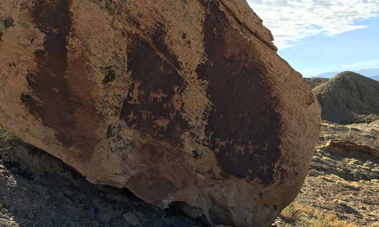
We have recorded small sites of varying types, large village sites, cave and rock shelter sites, burials, hunting blind sites, rock art, Traditional Cultural Properties, historic roads/trails, canals, homesteads, communities, historic structures, historic cemeteries, industrial sites, military sites, and communication sites.

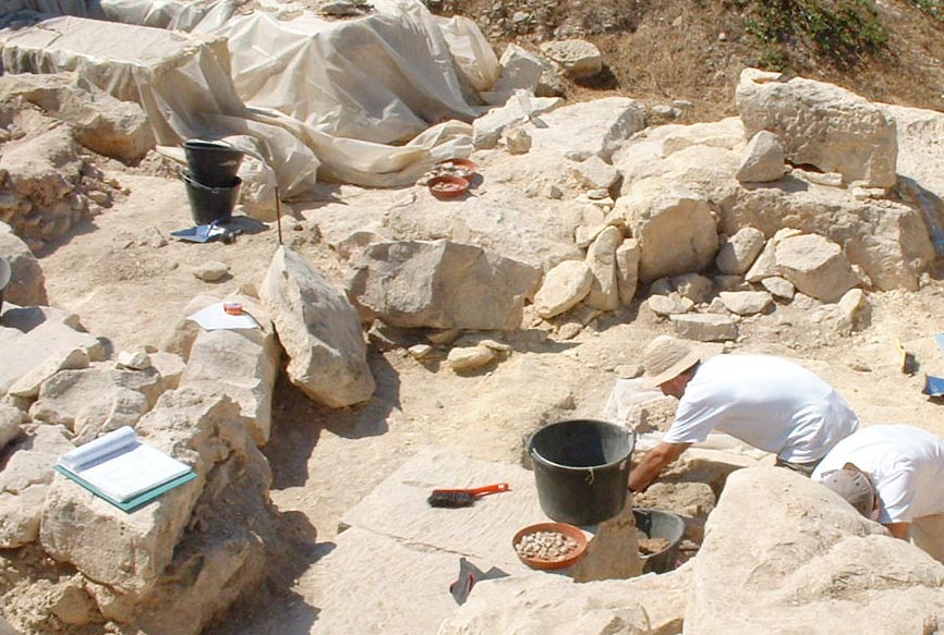
We have participated in the excavation or mitigation of complicated prehistoric sites such as open habitations, rock shelters, burials, lithic scatters, ceramic scatters, plant processing sites, and historic structures and features.  

We have an excellent understanding of the site and feature recording requirements of the Intermountain Antiquities Computer System (IMACS) used in Utah and Nevada, as well as site recording systems used in Idaho, Wyoming, Oregon, Washington, and Arizona.

Over the past seven years, Bighorn has completed over 300 projects. The following list includes a sample of the various types of projects undertaken by Bighorn.

Projects

Leucadia South Block Mitigation: This project involved the excavation of a prehistoric archaeological site and write-up of excavation work completed on five additional sites as part of a BLM land exchange located along the drainage of Fort Pearce Wash, Washington County, Utah.

Coalville Excavation: Bighorn excavated two historic pioneer burials that were encountered during construction associated with the expansion of a middle school within Coalville, Utah. The artifacts and bones dated from the mid to late 1800s.  

Jackson Flat Reservoir: This project consisted of a cultural resource inventory covering roughly 250 acres for a reservoir in Kanab, Utah for the Kane County Water Conservancy District.  Phase I test excavations are planned for 12 prehistoric sites identified during the survey.  Consultation with the Army Corps of Engineers and State and Institutional Trust Lands Administration was required.

Orderville Waterline:  This project included inventory of approximately 5 miles of waterline along US-89 and two water tank locations for the Town of Orderville, Utah.  Several prehistoric sites were identified as was a Civilian Conservation Corp flood control feature.  Consultation with UDOT and the BLM was required.

Leeds Main Street Enhancements:  This project consisted of an archaeological inventory of about 1 mile along Main Street / SR-228 through the Town of Leeds, Utah as part of a streetscape enhancement project.  Consultation with UDOT was required.

Grouse Creek Fiber-optic:
 This 240 mile fiber-optic project was located within Box Elder County, Utah.  Over 40 archaeological sites have been recorded, including several prehistoric sites from the Formative and Late Prehistoric time periods.

Pioneer Parkway Repair:  This project consisted of a cultural resource inventory of Pioneer Parkway within Santa Clara, Utah as part of the flood relief effort in 2005.  Consultation with UDOT was required as federal highway funds were utilized.

Lookout Pass to Callao Fiber-optic: Archaeological monitoring and testing of an archaeological site for the installation of an 80 mile fiber-optic line in Juab and Tooele Counties, Utah.

SR-118 Richfield to Monroe Turn Lanes:  This project consisted of a cultural resource inventory of about 4 miles along SR-118 between Richfield and Central Valley, Utah as part of planned improvements to the highway.